What's in the DuPont Plan? Nothing to Keep You From Loving the Forest
A spring ride through DuPont State Recreational Forest shows that the recommendations of a draft recreational plan are a reasonable response to crushing visitation.
Free option available
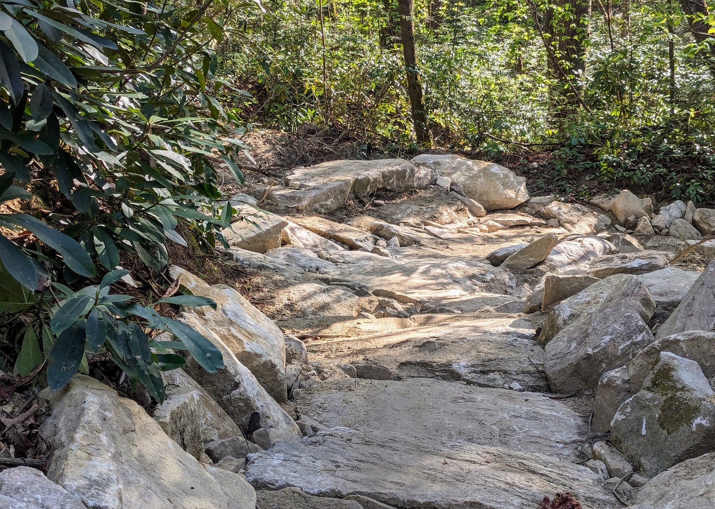
DUPONT STATE RECREATIONAL FOREST — Grassy Creek Trail — newly rebuilt and “armored” by tons of sturdy rocks — is a beautiful, wildflower-flanked route through prime bottom land in DuPont State Recreational Forest.
On a Monday bike ride, it provided a wormhole-like passage from the southern section of the Forest to the miles of trails and gravel roads to the north anchored by the Guion Farm Access Area.
Mountain bikers should love it for both those reasons. As for equestrians, well, it’s due to be closed to them under a draft of the DuPont Master Recreation Plan unveiled last month.
Monday was peak spring, a day when the season, as the old song says, was bustin’ out all over. I could just about see the green-leaf canopy spreading across the blue sky and the uncoiling of fiddlehead ferns. Somewhere in the Forest, I was sure, I could watch a trillium blossom open like it had been captured on time-lapse film.
But this was work, my friends. My route was designed to take in sections of trail where the Plan recommends either changing access or limiting the direction of travel — neither of which will happen for at least several months.
Tough duty, I know, but hopefully instructive to the million-plus hikers, horse riders, hunters, anglers and cyclists who visit the Forest annually.
The verdict, gleaned not only from this ride but from attending the reveal of the draft Plan at an elementary school in Mills River on April 6, matches what I heard from most of the attendees:
It’s a reasonable response to the impact of these crowds on habitat and an aging trail system never designed to accommodate them. It should limit potentially dangerous conflicts that may not be a major problem now, under the Forest’s traditional policy of open access to almost all users on almost all trails, but likely will be with the continuing crush of visitors.
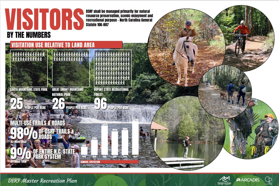
One of the most revealing displays at the school last month showed that DuPont receives nearly four times as many users per acre as the longtime symbol of overwhelmed natural areas, Great Smoky Mountains National Park.
A summary of the recommendations: Seventy-seven percent of the Forest’s trail system will remain as is, Forest Supervisor Jason Guidry said at last month’s event. Hikers and runners will see only tiny limits, and the restrictions on cyclists should be easy to plan around. Equestrians, on the other hand, might have a legitimate beef about Grassy Creek.
The details: I set off from the Lake Imaging Access Area, a popular starting point for cyclists that, at least from what I’ve seen in a few months as an avid mountain biker, is seldom used by horse riders.
Riding south on Lake Imaging Road I passed the base of Ridgeline Trail (more on which later), due for closure to horses and limits to uphill travel for pedestrians and downhill for cyclists.
Fine. I’ve never climbed it before and took my usual route up Jim Branch Trail, the only direction allowed to cyclists by the Plan.
Then Isaac Heath Trail, no change, and Lake Imaging, likewise. The same is true for the well-maintained gravel routes of Buck Forest and Conservation roads that I rode to Lake Julia.
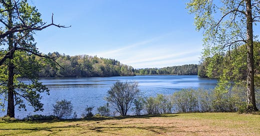
Forget the Forest’s landmark waterfalls. For the combination of peace and scenery, you can’t beat the lakeside picnic area. Or Lake View Loop, which passed beds of dwarf irises and foam flowers on a path overlooking steep banks plummeting to Julia’s most secluded inlet.
The plan calls for this to be part of the total of 5.2 miles of trail to be closed altogether under the Plan, an action less dramatic than it sounds.
It is designed partly to ease the maintenance burden created by these mostly short, little-used loops and dead ends. Hikers and runners will continue to be allowed to walk off the Forest’s designated trails, which means they will be free to roam almost all the remnants of trails that have been officially closed.
Pretty as Lake View is, I’ve never included it on a longer ride until Monday and did so then only to refresh my memory. Will its closure diminish the enjoyment of cycling in the Forest? Not much.
From there I moved on to a route I do regularly ride, Reasonover Creek Trail, which features a ford that will likely be replaced by a bridge. Can’t wait.
Climbing the trail’s lower section, I noticed a clear, fast-running stream that I had never appreciated on my usual, more rapid descents. But that “usual” is the key word here. I doubt the Plan’s directional restrictions on this trail — up for horses and down for cyclists — will cause many riders to alter favorite routes.
No planned changes to Turkey Knob or Briery Fork trails, or to Joanna Road, which leads to the newly upgraded Grassy Creek.
Why is it being closed to horses? “Degradation of the soil. And it can’t be realigned because of constraints on the watershed,” Kirsten McDonald, the Forest’s information and education supervisor, said at last month’s event.
Trail builder Shirmper Khare, whose Pisgah Pathologists LLC completed the recent reconstruction, offered more details. Options for rerouting are limited by surrounding land that has been designated under the North Carolina Natural Heritage Program because it is home to both rare plants and the green salamander, listed by the state as endangered.
The trail is also very sandy, he said. “There’s no clay base and when horses go uphill they displace soil pretty excessively. I mean, it’s just a fact that they’re putting 500 pounds on each hoof.”
Still, equestrians such as Jerry Brown, an endurance racer and trail advocate, will face the same frustrations experienced by cyclists when the trail was closed for improvements.
He usually parks at the recently expanded Guion Farm lot, he said, and the future restriction on Grassy Creek “is effectively closing off more than half the Forest for me.”
It should be noted that the Plan does make several accommodations for horse riders, including the designation of horse-and-hiker only trails near Guion. The same classification will apply to the nearly nine miles of new trails planned for an undeveloped parcel of the Forest south of Reasonover Road.
And maybe something can be worked out. Khare suggested that the relatively few horse riders who use Grassy Creek try the newly hardened route until the Plan goes into effect, allowing Forest staffers to monitor how well it holds up. And Sara Landry, executive director of Friends of DuPont, said she has been discussing with equestrians how connections can be made on existing trails.
On to the conclusion of my ride, down Hooker Creek and Ridgeline trails. Descents on Hooker Creek are probably fast and popular enough to justify its closure to equestrians, who, in compensation, will receive a new, bike-free stretch of trail nearby. It’s part of a strategy to prevent conflicts on land between Guion and Lake Imaging that is heavily used by both groups, Guidry said.
That’s also one reason behind the planned exclusion of horses on Ridgeline, site of the only recommended limit to hikers, who will only be permitted to walk uphill.
Which is probably for the best. On dozens of rides on Ridgeline, I’ve watched plenty of mountain bikers fly down this famous descent. Meanwhile, I’ve seen very few hikers and precisely one group of equestrians, who seemed to be riding it mostly to make the point that, at least for now, they can.
Ridgeline deposits bike riders a few hundred yards from the Lake Imaging lot, meaning rides from there are capped with an exhilarating plunge.
That won’t change once the Plan is in place. As for the overall opportunity for all users to get out in the woods and, if they like, take the time to absorb the features of each season, I don’t think that will either.
Email: brevardnewsbeat@gmail.com


Great informative article- thank you Dan
Thanks Dan. Great article, very informative.