The Debate over the Future of a DuPont Trail System "Hammered" by Big Crowds
Consultants are drawing up the first comprehensive recreation plan in the Forest's 23-year history, aiming to protect trails and prevent user conflicts. Should it impose restrictions on trail travel?
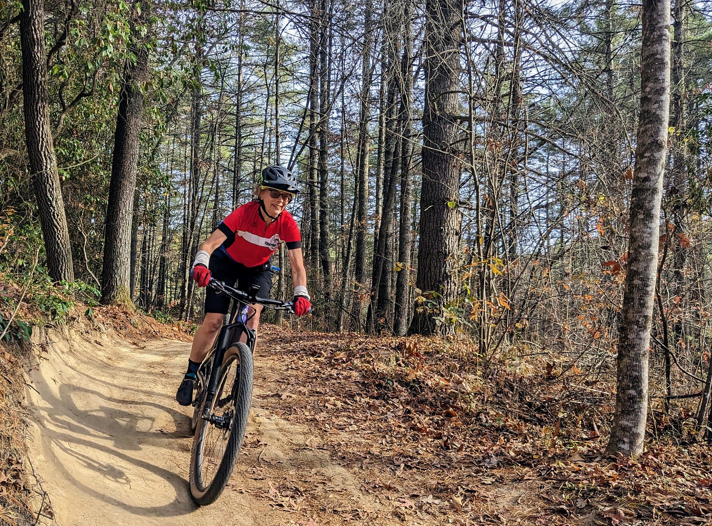
CEDAR MOUNTAIN — In DuPont State Recreational Forest last week, Jane Dauster walked on a stretch of old dirt road disguised as a popular single-track cycling path.
The road was cut diagonally across a steep hillside above Fawn Lake, its bed inadvertently but perfectly positioned to capture runoff from the slope and funnel it in a straight, fast-flowing stream down what is now a section of Mine Mountain Trail.
Until this can be rebuilt on gentler grade, Dauster said, the resulting “water hammer” — along with heavy user traffic — will keep pounding away at the hand-built features designed to divert the flow.
“There’s no way to keep water off this trail,” said Dauster, the Forest’s recreation specialist. “This is a classic example of where we adopted an already existing road that wasn’t meant to be a sustainable trail.”
It’s also a clear picture of the two main reasons that ongoing work on the DuPont Master Recreation Plan is not just badly needed but long overdue:
Old trails and big crowds.
The plan, now budgeted at $300,000, was approved by state lawmakers in 2021 and is due to be complete next spring. Consultants recently wrapped up one of its first phases, taking public input that has sparked a debate over possible changes to the Forest’s tradition of freedom for all users to travel all directions on almost all trails. Or whether it should change at all.
But there is no argument about the value of the plan’s larger goal, to protect and improve the Forest’s roughly 75-mile network of single-track paths and gravel roads that “just kind of happened organically,” Dauster said.
Some are “inherited” logging roads and jeep paths, she said. Others were built shortly after the Forest’s creation in 2000 — mostly with volunteer labor and without the advantage of subsequent, dramatic advances in sustainable trail-building techniques.
And, of course, without any idea that the Forest would become one of the region’s most popular outdoor destinations, attracting a record 1.3 million annual visitors during the peak of the Covid-19 pandemic and only slightly fewer in the two years since.
“We wanted to bring in some recommendations to help this place handle the high use with the new knowledge that has been developed in the past 25 years,” Dauster said, describing the purpose of the plan.
“We want to know how to make recreation work better in the long run and how to balance conservation with heavy use.”
The Plan
The 12,400-acre Forest draws not just a lot of visitors but a wide variety of them:
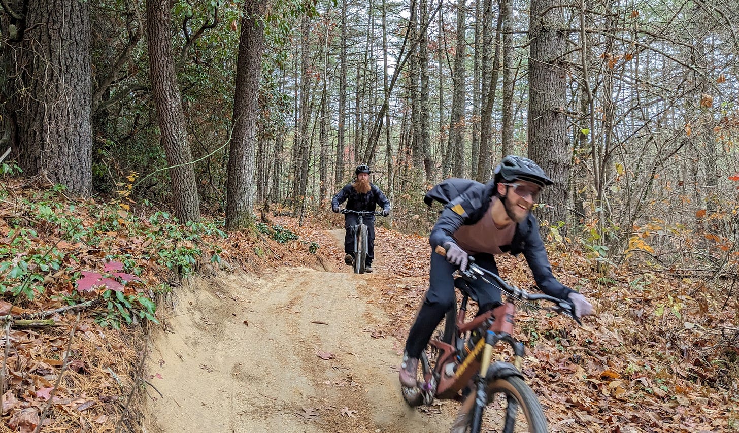
Horseback riders; mountain bikers ranging from small children tagging along after parents to thrill seekers intent on posting fast times on the cycling social media site, Strava; pedestrians that include serious, fast-striding runners as well as visitors satisfied by the leisurely, often crowded walk to the Forest’s most popular attraction, High Falls.
Then there are anglers, who demand clear, fast-flowing streams, Dauster said, “and we have people who need remote, untrailed anchors for their use, which is hunting.”
Adding to the challenge of satisfying these users are restrictions imposed on the roughly 1,750 acres in the forest included in the North Carolina Natural Heritage Program because of ecological significance such as the presence of rare or endangered plant species.
The language that accompanied the state appropriation of $200,000 for the plan — as well as $550,000 for later implementation — describes its aim broadly as addressing all the Forest’s “recreational infrastructure.”
The scope grew broader still after the tourism development authorities of Henderson and Transylvania counties added a total of $100,000 for the plan’s contract, awarded to regional engineering firm Mattern & Craig.
The additional funds will allow the company to study, among other issues, possible E-bike use in the Forest and connecting its trail network with regional multi-use paths.
But because the vast majority of visitors use the trail network — and because it is showing so many signs of overuse — this will be the focus of the plan, Dauster said. And at the last public input session, held on Nov. 4 at the Transylvania County Parks and Recreation Gym, the particular focus was potential changes to use on some segments of this network.
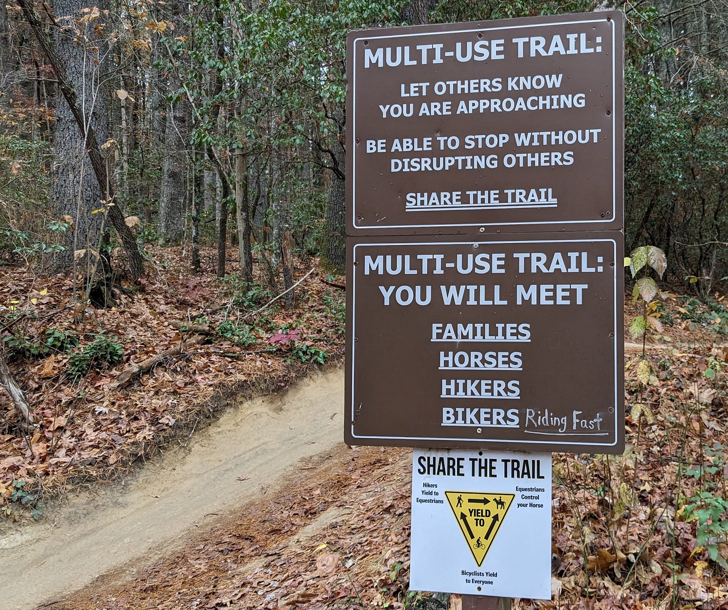
Currently, with the exception of a few short stretches, all the Forest’s paths are open to all uses, restricted only by the simple directives that pedestrians yield to horses and bikers yield to everybody.
Attendees of the input session were asked to rate their preference for a range of “conceptual” amendments, ranging from a “minimal level of change” to “most level of change.”
On the least-dramatic end of the spectrum, the proposals called for restricting either access or direction of travel to only a handful of trails, and, on the other end, to more than a dozen.
But every one of these options listed a 1.4-mile stretch of single-track at the center of the debate about potential user conflict — the swooping, nationally known destination for mountain bikers, Ridgeline Trail.
The Case for Multi-Use
As Danielle Rowland stood at the base of Ridgeline last Saturday, her comments were sometimes drowned out by the sound of whizzing bikes and tires skidding to a stop at the trail’s junction with Lake Imaging Road.
Riders chatted excitedly as they regrouped before peddling to the nearby parking lot, and in online reviews cyclists have described the descent of Ridgeline as “flowy,” “better than a roller coaster,” and “LIKE BUTTER!!”
Doesn’t this popularity with high-speed riders make the trail an obvious candidate for restrictions?
Not at all, Rowland said.
Once an avid bike rider and now a trail runner, she said the current multi-use system works just fine. So did, in a later phone interview, Rhi Banks, a professional equestrian ride leader who works in Forest. And so did many of the other members of the equestrian group she belongs to, Pisgah Trailblazers, who participated in a focus group shortly after the Nov. 4 public input session, Banks said.
Though she said she might be open to restrictions on direction of travel — especially the proposal allowing only downhill cycling traffic on Ridgeline and only uphill travel for pedestrians and horses — she and other horseback riders generally “like the concept of keeping everything multi-use,” she said.
In support of this view, Rowland, 43, cited a display at the meeting that showed a vast majority of the more than 3,000 respondents from earlier input sessions and surveys think the current network either “works well,” or “works well with some occasional issues.”
Most cyclists Banks encounters, she said, “go above and beyond” when she asks them to give her horses a wide berth.
“That’s something that’s really cool about DuPont,” said Banks, 25. “I feel like that courtesy rule is really well followed.”
She also saw that spirit of cooperation when she volunteered with Friends of DuPont Forest— the nonprofit that performs most routine trail maintenance — to remove invasive plants. She worries such “mutuality” might be undermined if cyclists or equestrians are asked to work on paths they can no longer access.
“It’s so fun to work with other users to do trail work,” she said. “I think we are all adults and I think we can get along and be polite.”
Rowland says mountain bikers on Ridgeline would ride at higher speed and with less regard for other users if not for the prospect of coming upon large, slow-moving horses.
“If cyclists don’t have to worry about a horseback rider, they’re going to go ‘woo-hoo!,’ ” she said, imitating a bike rider in full flight. “And then they encounter me. What are they going to do? All of a sudden yield?”
But she also sees even changes to directional travel on Ridgeline as a looming threat to visitors other than cyclists, the largest user group in much of the Forest.
DuPont began attracting even more mountain bikers after it reworked Ridgeline in 2022, she said.
This project was touted as protecting a path that Rowland saw on her runs as mostly “stable and healthy with zero erosion problems.” The added curves and jumps delighted cyclists but created cross-slopes hazardous to pedestrians and equestrians.
This trend of accommodating bikes would be further advanced by limiting runners and horses to uphill travel, she said.
Yes, she said, it would be a modest change, but it’s a “change that would cater to making Ridgeline a downhill trail for bikers, and guess what?” she asked before answering her own question.
“Precedent . . . If that could be done to Ridgeline, it could easily be done to any other trail in DuPont.”
Making Trails Safe — and Sound
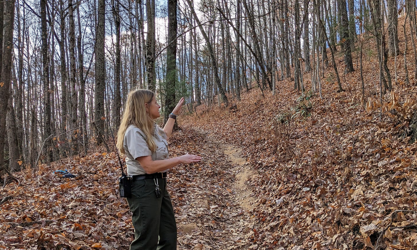
Is there really a long-term plan to favor cyclists over other users?
“Oh, gosh no,” Dauster said on her walk in the Forest on Thursday, when she offered a broader view of trail projects.
They are all primarily intended to protect paths from wear and weather, she said, and pointed to ongoing work to improve a total of five miles of the Briery Fork, Wintergreen Falls, Hilltop and Grassy Creek trails.
This has entailed adding dirt, rocks and drainage features, none of which made these trails more thrilling for cyclists. Neither did most of the 2022 project that included upgrades to Ridgeline, but also to more than five miles of other paths.
For further context, she added that the work on Ridgeline accounted for about $18,000 of the $109,000 spent on this project. And only the bottom half-mile of the Ridgeline was rerouted, she said.
The new undulations on that stretch are not jumps, Dauster said, but “grade reversals” that redirect water flow and extend the life of the path.
The curves were also designed to harden the trail’s use from both the heavy rainfall the Forest receives — at least in typical years — and the heavy downhill cycling traffic on that has long been deeply “ingrained.”
Straight sections of the trail were eroding faster than the banked bends, she said, “and one of the techniques we used was rerouting parts of it and adding some curves . . . because the curved sections were not eroding at nearly the rate of the straight-line sections.”
“If you look at how all those trails have been reworked,” she concluded, “I do believe that is supportive of managing for multiple uses.”
As to Rowland’s other point, that Ridgeline is safer because of the care required to account for a variety of users traveling in both directions, it’s easy to find users who disagree.
One of them is Amanda Bedard, 62, a Friends volunteer and resident of Henderson County interviewed after finishing a conservative descent of Ridgeline last week. She “absolutely” favors some restrictions in the name of safety and sees little sign that the most aggressive riders are currently exercising caution.
Though Dauster said she doesn't know of any recent injuries caused by collisions between riders and other users — and though Bedard agreed that users are generally courteous — the cyclist also often sees riders descending at unsafe speeds.
“There is world-class cycling here and people like to come here and make their mark on this trail,” she said, referring to riders seeking to post times on Strava.
“And they are going dangerously fast.”
The Larger Goal
Another display at this month’s meeting suggested that many other users are least open to change.
Along with the findings from previous surveys and meetings that Rowland highlighted — the ones showing support for the current system — was a chart tracking responses from members of the public asked if they “would be supportive of trail reroutes or closures to support improvements such as a more cohesive trail system.”
More than 80 percent of the nearly 3,300 respondents answered “yes.”
That total number of participants backs a statement from Kirsten McDonald, the Forest’s Information and Education Supervisor, who wrote in an email that the public input portion of the planning process has been “very robust.”
It’s also important, McDonald wrote.
But it is not the only information that planners will apply.
They have also been conducting traffic counts of various users on the trails, as well as analyzing the conditions and potential for conflicts on these paths.
In writing the plan, Mattern & Craig will consider “the public’s wants/needs alongside the Forest’s need for sustainability, wildlife habitat, water quality, compliance with natural heritage designations and . . . environmental regulations.”
“Developing a master recreation plan is not a public vote or contest between user groups.”
And when that plan is released, said Sara Landry, executive director of Friends, visitors should also look at goals beyond improving “their unique experience” of the Forest.
They should look at what is best for all of DuPont — and at the damage done by the current pattern of use.
“It’s an inherited trail system,” she said, “and it’s getting hammered.”
Email: brevardnewsbeat@gmail.com


Yes!
1. Limit cyclists to 3- 4 days per week, with one day per weekend bike-free.
2. Charge an admission fee. Per person, with Cyclists charged an extra Trail Usage Fee.
Just those two things need to be done. THEN, do your trail maintenance projects.
Alternatively, close DuPont for a Democratic this winter to make Trail upgrades.