Fred's Flood Was Bad. Future Flooding Is "Very Likely" to Be Worse, Climate Study Says
High waters washed out roads, inundated homes and forced evacuations. But as the globe warms, such events are expected to become more severe and far more frequent, climate scientists say.
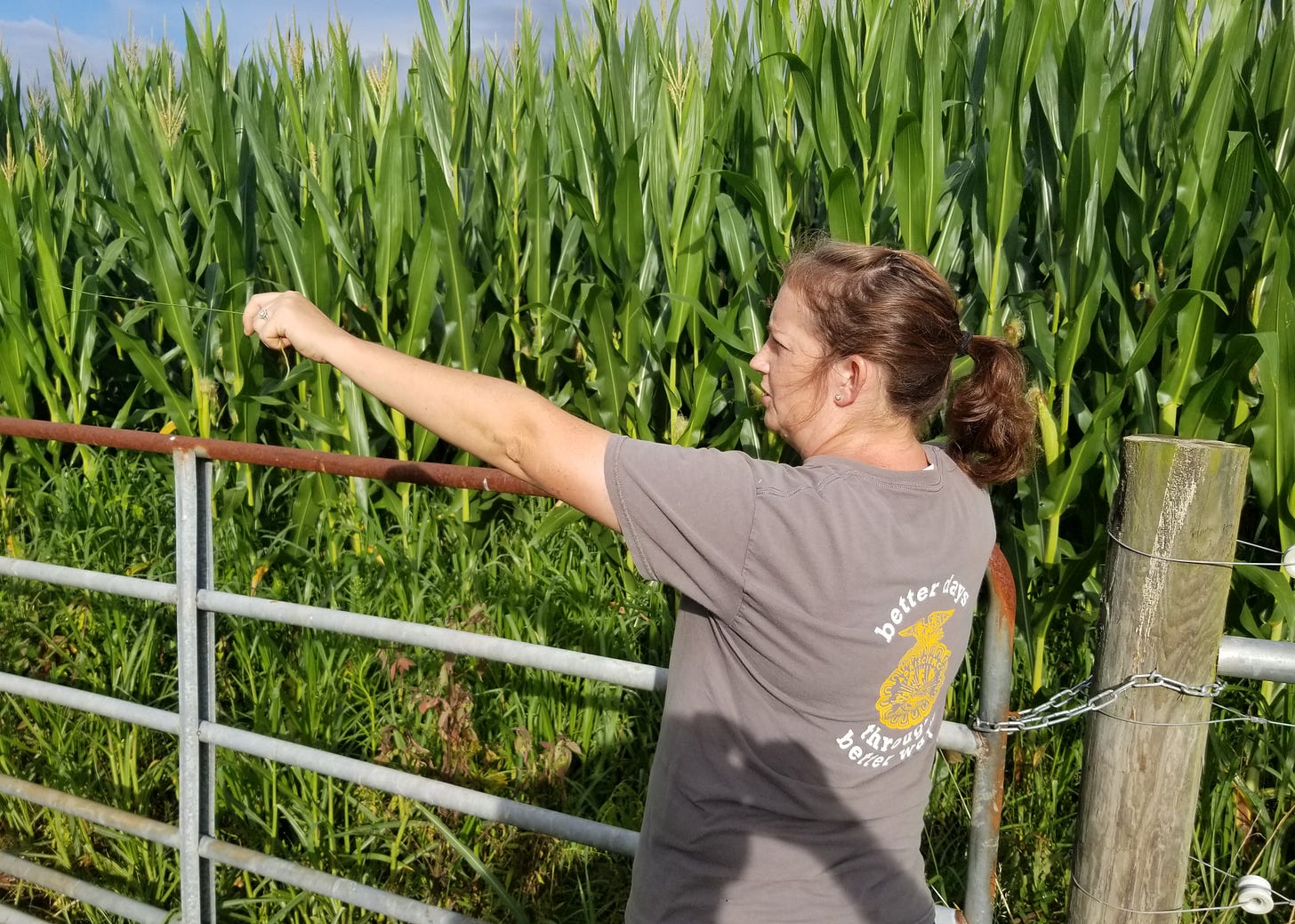
BREVARD — Brevard High School agriculture teacher Sarah Clayton walked the grounds of the school’s farm on Friday, pointing to shredded fencing and flattened corn, part of what she expects to be about $6,500 in total damages from last week’s flood.
But as bad as it was, she said, future storms could easily be worse.
Last week, she was able to shelter the farm’s pigs, goats and cows in the farm’s high-and-dry barns. If the nearby French Broad River had risen much higher, she said, it would have forced her to find another refuge.
“We have over 50 animals on the property. How can you evacuate more than 50 animals? I always said it would never flood enough for that to happen,” she said, looking toward a shed near the barns that marked the farthest point of the flood’s advance. “But after this week, I’m like, it probably could, because it got so close.”
Clayton is right to be concerned, according to climate scientists.
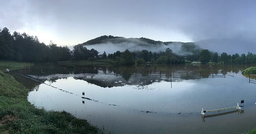
Fed by moisture from the remnants of Tropical Storm Fred, both rainfall and river levels approached decades-old records last week in Transylvania County, and flooding damaged at least 25 structures, some of which were inundated with as much as 10 feet of water, said County Manager Jaime Laughter.
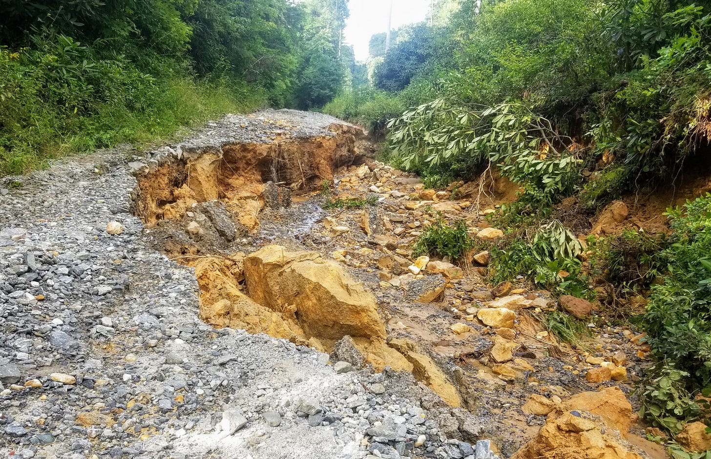
The surging water forced residents into shelters, submerged roads, destroyed crops and washed out trails and gravel roads in Pisgah National Forest. The county’s total damage estimate of $11.2 million, reported at the end of Wednesday, is a preliminary number and likely to climb much higher, Laughter said.
But it may be just a preview of things to come.
Overall rainfall in the county has been trending upward in recent years, and 2020’s North Carolina Climate Science Report predicts that extreme rains — defined as more than three inches — will occur between twice and three-and-a-half times more frequently by the end of the century.
And not only will big rains happen more often, said Ken Kunkel, Lead Scientist for Assessments at the North Carolina Institute for Climate Studies — as warming bodies of water pump more moisture into the air, the storms are also likely to be more severe.
“With more water vapor, we can expect that the intensity of future extreme events will be greater,” he wrote in an email on Friday.
The High Cost of High Water
Though it will take weeks or months to assess the full scope of the damages from Fred, the storm did show that such extreme rains result in extreme costs and disruptions.
The National Weather Service Station at Brevard recorded the highest three-day total, 10.7 inches, since the 14.7 inches measured in mid-July of 1916 (shortly before what was probably the biggest flood-related disaster in county history, the bursting of the Lake Toxaway Dam), said Jeff Robel, from the National Centers for Environmental Information in Asheville.
Though his office did not yet have reports from volunteer-run stations in the western Transylvania, other sources show that this area received the storm’s heaviest rains, especially on late Sunday and early Monday.
The gauge at Gorges State Park measured about a foot of rain early last week, said Park Supervisor Kevin Bischof and, Laughter said, “we know we had rain gauges that reflected as much as 15 inches on Sunday night alone in that area of the county.”
That rainfall showed up in gauges on both the Davidson River and the French Broad, which in Rosman crested at 14.18, about five feet above flood stage and just short of the 1964 record of 14.95 feet, said Jason Fine, the assistant data director for the U.S. Geological Survey in North Carolina.
More significantly to county residents, the rainfall’s impact was seen in damage to roads, trails, homes and farms.
On Tuesday night, emergency personnel “evacuated countless county residents and visitors including campers from (Pisgah’s) Davidson River Campground. This included swift-water rescue,” a county press release stated.
That county had found at least $2.1 million in damage to local roads, the release said, and workers were just beginning to estimate damages to, especially, private lanes, Laughter said.
State-maintained highways in the county may also need expensive repairs, said David Uchiyama, a communications officer for the state Department of Transportation. Though the assessment of permanent damages had just begun, he said last week, he listed at least four roads that had been closed due to flooding last week.
In a Thursday press release titled “Tropical Storm Fred Causes Severe Damage to the Pisgah Ranger District,” the U.S. Forest Service reported staffers “have found bridges out, trails eroded and trees down. Because of this we are discouraging the use of the Forest for the safety of staff and visitors alike.”
By late Friday, according to a second press release, US 276, most of which had been previously closed, was reopened to the Blue Ridge Parkway. But the Service continued to discourage visitation because of conditions that included unstable roads and several large log jams on the Davidson, including one covering about a half-acre just above Looking Glass Falls.
“Swimming is completely unsafe at this time,” it said.
Farms suffered widespread inundation of pastures and crops, said county extension director Bart Renner, and can expect future losses from long-term impacts.
“Consistently wet conditions bring a lot of mold, fungus and other diseases that are very bad for yield, obviously,” he said.
He urged farmers to report damage both to his office and to the U.S. Department of Agriculture’s Farm Service Agency in Hendersonville at 828-693-1406.
A county press release, meanwhile, encouraged residents interested donating money to flood victims to contact Change the World Relief Organization and anyone suffering damages to report them to the county communications center, at 828-884-3188. This information, the release said, will “help facilitate bringing state and federal aid into the community for those in need.”
Future Flooding
Yes, last week’s flood was bad, said Vess McCall, 87, who added that it swamped about half of his 14-acre pasture in Rosman.
“When the water gets on it, and washes the gravel and sand on it, it damages it right smart,” he said.
But he has seen plenty of storms in his 45 years farming that pasture, he said, and dismissed the notion that global warming has, or will, bring more such events.
“I think a lot of it is in people’s minds, to be honest with you,” he said.
This gets to a well-known fact: Transylvania has always been one of the wettest counties in the East. And determining how much wetter it has become is tricky partly because historic records are riddled with gaps, including incomplete records for years such as 2004, known to be among the rainiest in the region’s history.
But factoring in only years for which complete records are available, these statistics show a distinct if short-term upward trend in rainfall. In Brevard, for example, the average annual rainfall over the past five years, 85.5 inches, is about 10 inches higher than the overall average dating back to 1950.
And while Brevard never recorded more than 100 inches of rain in any year before 2013, according to available records, at least that much has been measured in three years since.
Bischof said Gorges staffers have long told visitors that the park receives about 90 inches of rainfall per year. Though he does not know the precise source of that number, he said, it looks as if it may have to be revised upward.
Since 2015, when the park began consistently measuring rainfall, the smallest amount measured almost exactly matched that presumed historic average, while in four of those six years, the park recorded annual rainfall of more than 100 inches, including a whopping 136 inches in 2018.
This mirrors the findings about the region in the state Climate Science Report, which noted that recent years have been some of the rainiest in the history of Western NC.
But partly because one of the hallmarks of climate change is increased variability of weather — droughts are also expected to become more common, for example — it labeled the prospect of more total rainfall as merely “likely” by the end of the century.
The big change is expected to be in extreme rainfall events, the frequency of which has matched the trend in total rainfall; the numbers of these big rains documented in the Western North Carolina have been well above the region’s historic average since 2010.
Most of the mountains’ water comes from the Gulf of Mexico, and the warmer that water, the more moisture it produces in the air, said Kunkel, one of the report’s authors.
“Based on the virtual certainty that water vapor in the atmosphere will increase as global warming occurs,” the report said, “it is very likely (bold original) that the risk of extreme precipitation will increase everywhere in the Mountains.”
Preparing for the Next One

That is the trend Renner has already noticed, he said, and the one that represents the biggest threat to the county’s farms — which, because they typically lie in flood plains, are especially vulnerable to high water.
“The problem is not necessarily in getting more or less rainfall, but the rainfalls, when they do come, are more concentrated,” he said, and “a larger amount of fluid in a shorter amount of time creates more erosion.”
Farmers in Transylvania, with its history of heavy rains, have long adopted practices to cope with it. A well-maintained pasture effectively holds soil, for example, and cattle can be moved to higher ground.
“I think that’s why livestock farming has historically been so popular here, because when your crop has four legs, it’s a lot easier to move around,” Renner said.
But with the prospect of bigger rains in the future, he has urged growers to take additional steps to control erosion, including, above all, he said, “keeping roots in the ground,” which means “cover cropping, planting a diversity of crops if possible, crop rotation and whatever we can do to keep soil from being bare.”
Clayton said her program has placed renewed emphasis on soil control, especially by working to stop a cycle that promotes erosion.
When floods remove good soil, grass is displaced by weeds, which cannot hold ground as well as pasture, which, in turn, allows even more erosion.
“We look at ways to keep our grass good and thick and eliminate a lot of the weeds,” she said.
This includes raking manure so it can be more easily absorbed into pasture, collecting it so it can be composted for six to nine months and then spread to build topsoil, she said. “And we’re looking at a lot of good environmental ways that we can control the weeds.”
These practices not only protect farmland, she said, they protect area rivers. The French Broad in particular has seen a spike in E. coli levels, according to the MountainTrue environmental organization, which pegged waste from livestock, along with septic tanks and sewer systems, as one of the main sources.
“I think that’s a responsibility that any farmer who’s been here a while keeps in mind — how these farms effect the river, how they effect the community,” Clayton said.


It's a bit wonky but you can get 2004 data from the USGS river gauge site - https://waterdata.usgs.gov/nc/nwis/dv?cb_00060=on&cb_00065=on&format=gif_default&site_no=03439000&referred_module=sw&period=&begin_date=2004-06-01&end_date=2004-12-31
For some reason September 1-30 returns no data but search a larger time-frame and you get a result.